BasinVisPy

![]()
BasinVisPy is a modular Python-based open-source modelling platform designed to provide a comprehensive suite of tools for quantitative analyses, advanced visualization, and multi-dimensional simulations. By leveraging geoscientific big data and emerging computational approaches, including machine learning, BasinVisPy will enable new ways to investigate complex Earth system processes.
Earlier versions of BasinVis were developed in MATLAB®, but functional and accessibility limitations motivated the transition to Python, ensuring broader applicability, scalability, and open access. The subsidence analysis module from BasinVis 2.0 has been redeveloped and released in BasinVisPy, while additional modules are being redeveloped with a more accessible and user-friendly graphical interface.
Building on international collaborations and recent advances in computational geoscience, we aim to introduce new capabilities in BasinVisPy, such as quantifying the influence of sediment thickness on crustal and thermal dynamics, reconstructing paleobathymetric and sea-level variations, and detecting climatic cycles recorded in sedimentary archives. These tools are being designed to integrate sedimentary, tectonic, environmental, and climatic processes, advancing both basin analysis and Earth system modelling.
We warmly invite feedback and ideas from the geoscience community to guide BasinVisPy's ongoing development. The ultimate goal is to deliver broadly transferable insights and predictive tools that not only support diverse research applications but also deepen our fundamental understanding of the dynamic Earth system.
Sourcecode
The subsidence analysis module of BasinVisPy is currently hosted on Github:
GitHub Repository
Please contact the authors if you have further questions.
Eun Young Lee (eun.lee [at] univie [dot] ac [dot] at)
Johannes Novotny (jnovotny [at] vrvis [dot] at)
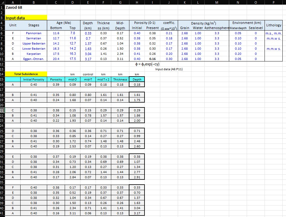
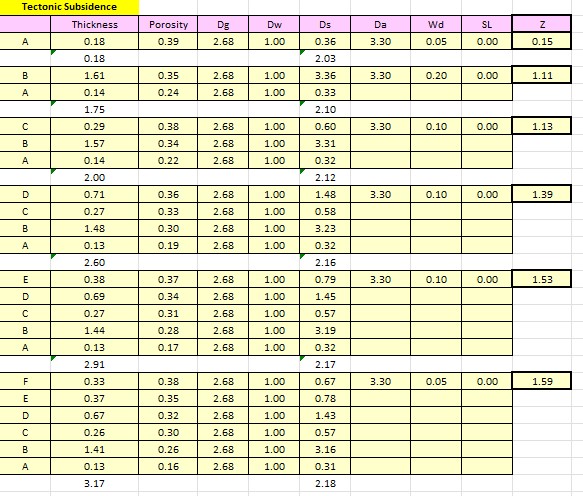
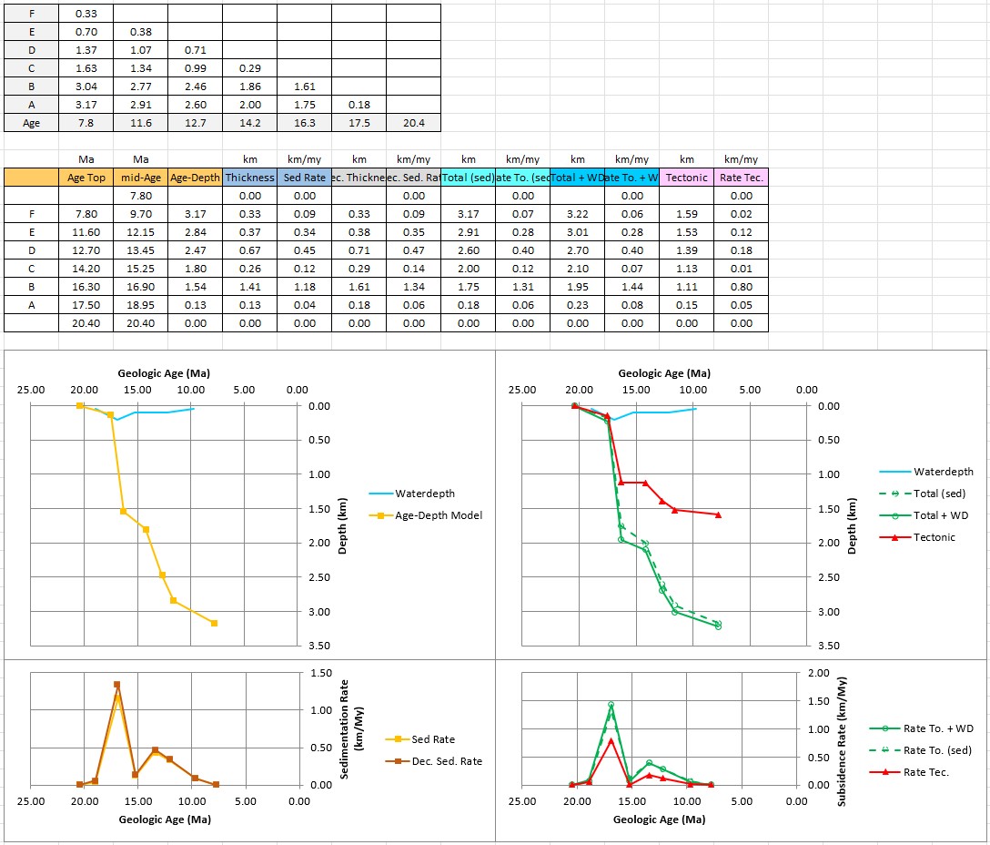
Screenshots